Maps
This is a thumbnail gallery page so please click on the small images to see them larger.


Map of Western Australia showing the location of Smiths Beach in the south west corner of the state.
Map of the Cape Naturaliste Region showing the location of Smiths Beach in relation to the major population centres of Busselton and Dunsborough.
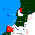
Map of the Smiths Beach area showing the proposed development site. Note that the site lies directly between two areas of coastal National Park. The vegetation on the site currently provides a link between the areas of National park."
.(Close
this browser window to get back to the action at Smiths Beach)